Skaftafell Glacier is a 12 km outlet of Vatnajökull, Europe's largest ice cap, on Iceland's south coast 327 km east of Reykjavík — where easy viewpoint trails, the basalt-column waterfall Svartifoss and year-round guided glacier hikes sit beneath one of Iceland's most destructive volcanoes.
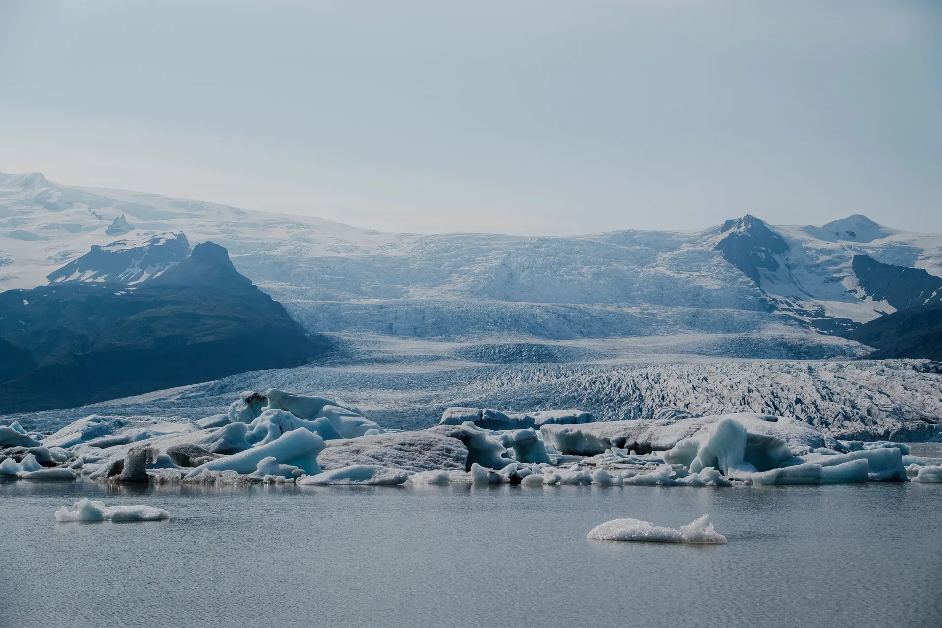
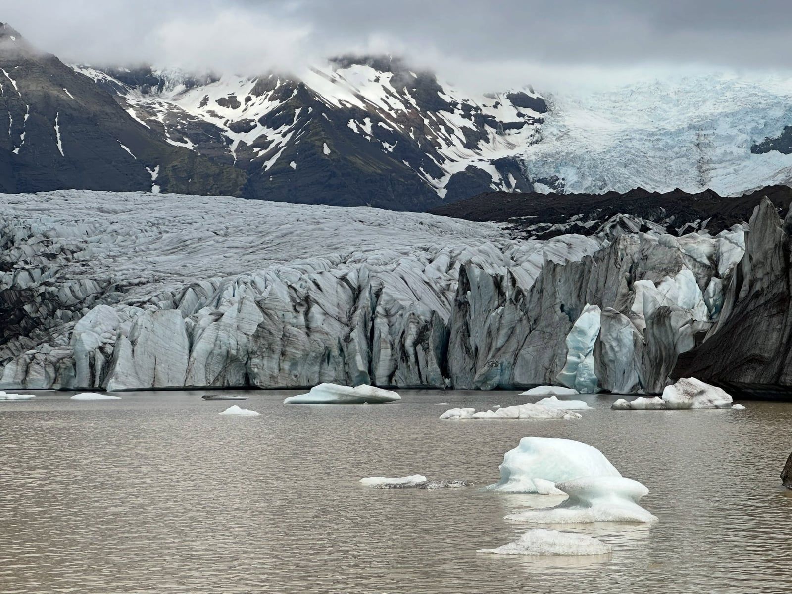
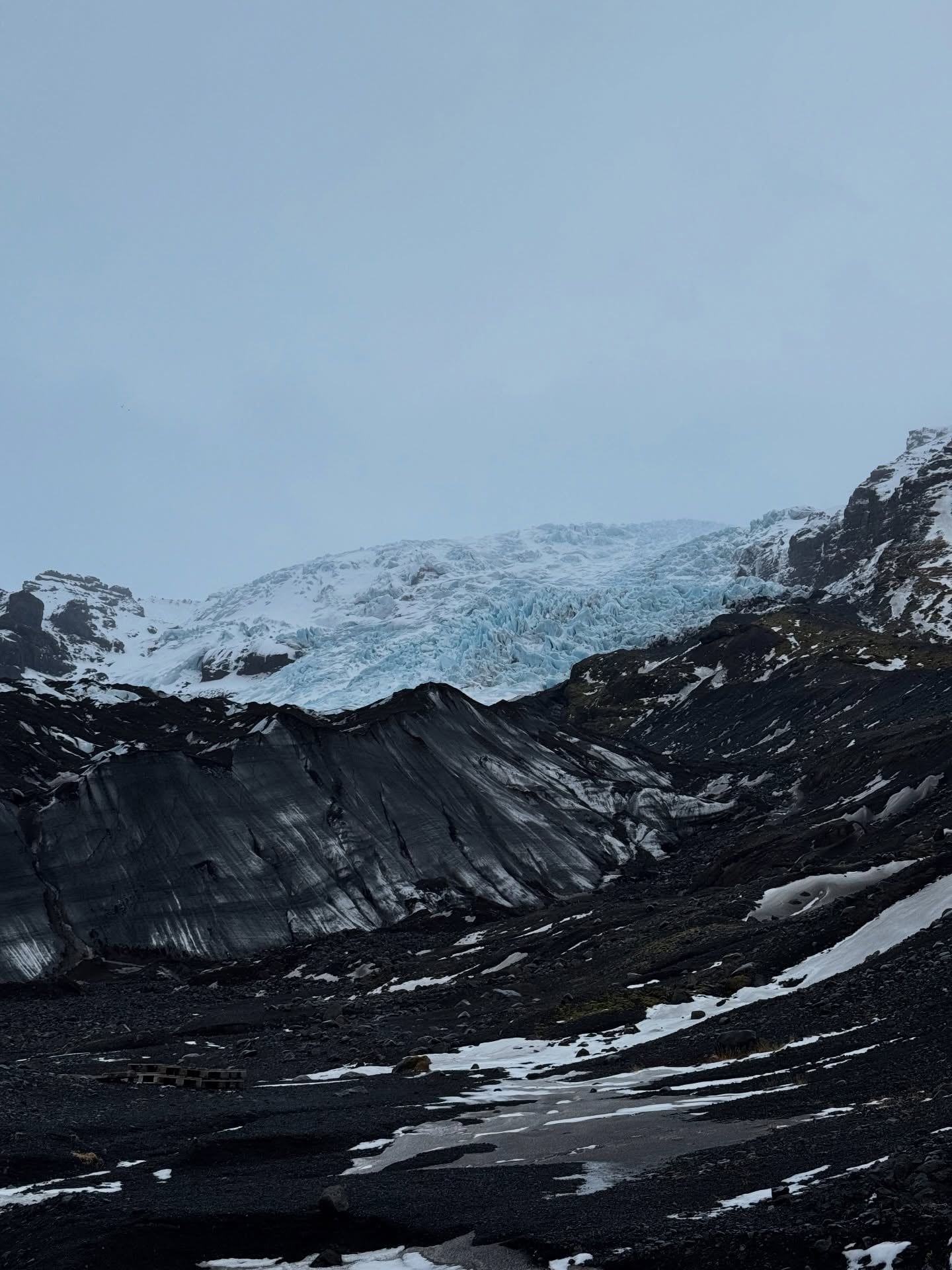
Skaftafell Glacier — Skaftafellsjökull in Icelandic — is a 12 km outlet glacier flowing off Vatnajökull, Europe's largest ice cap at about 8,100 km², on the south coast of Iceland, 327 km east of Reykjavík and signposted straight off the Ring Road. It starts as two icefalls, each about 1 km wide and 400 m tall: one spilling from the ice cap, the other from the Öræfajökull volcano. They merge behind a medial moraine, a dark seam of rock that runs the length of the tongue. Below, ice averaging 250 m thick squeezes between the Skaftafellsheiði heath and mount Hafrafell, and the snout now ends in a grey meltwater lake that didn't exist before 2010.
You can't walk on this glacier any more. It has retreated too far, so guided crampon hikes leave from Skaftafell Base Camp for neighbouring Falljökull, and Skaftafellsjökull itself is seen from a 4.1 km viewpoint loop across the moraine. Most visitors pair that loop with the Svartifoss walk — 5.8 km round trip, about two hours, ending at roughly 20 m of falling water framed by black hexagonal basalt columns. From October to April, the same operators run four-hour blue ice cave tours. Entry to the park is free; parking costs ISK 1,110 per car and covers the calendar day. Budget two to four hours on foot, or a full day if you add a guided ice hike.
The area became a national park on 15 September 1967 and joined the UNESCO-listed Vatnajökull National Park in 2008. Since 1999 the glacier has retreated an average of 53 m a year, and it has become one of the places Iceland points to when explaining climate change — the numbered markers on the viewpoint trail stand where the ice stood within living memory. The district carries an older and darker story too: the 1362 Öræfajökull eruption destroyed the settlement here and left the region with the name Öræfi, 'the wasteland'.
Skaftafell was a manor house and a local meeting place through the Middle Ages, a rare pocket of fertile, sheltered lowland under some of Iceland's tallest mountains. In 1362 the volcano beneath Öræfajökull erupted in the largest pumice eruption in Iceland's recorded history. It buried farms in ash, wiped out the community, and the district acquired the name Öræfi — 'the wasteland'. People returned over the following centuries, and the birch woodland you walk through on the Svartifoss trail is part of that long recovery. The name stayed.
The ice has its own readable history, written in the moraines it left behind. Around 1700, Skaftafellsjökull was joined to its neighbour Svínafellsjökull, and between them the two tongues held mount Hafrafell locked in ice until 1935 — a measure of how far these glaciers can travel within a few lifetimes. Lichenometry dates the maximum extent to roughly 1870-1880. The tongue then pulled back 1.3 km between 1932 and 1967, held nearly stable for the next three decades with a small readvance in the mid-1990s, and has since lost more than a kilometre. The average retreat since 1999 runs at 53 m per year. In 2010 the shrinking snout exposed a basin deep enough to flood, and the glacier has ended in a lake ever since.
Skaftafell National Park was founded on 15 September 1967, in part to protect the heath vegetation of Skaftafellsheiði, and was enlarged twice. On 7 June 2008 it merged into Vatnajökull National Park, now inscribed as a UNESCO World Heritage Site. Protection didn't quiet the landscape. On 5 November 1996 the Gjálp eruption under Vatnajökull melted enough ice to send a jökulhlaup — a glacial flash flood — across Skeiðarársandur, peaking at an estimated 50,000 m³/s. It tore out the 880 m Skeiðará bridge, opened in 1974, spread some 12.8 million m³ of sediment across the outwash plain, and cut the Ring Road between Skaftafell and the sea. Two twisted steel girders, left standing beside Route 1 just west of the park, mark the spot.
Today Skaftafell is the busiest hub on the park's southern side. Glacier-hike operators base themselves here year-round, the campsite beside the visitor centre fills through summer, and in winter the same guides lead blue ice cave tours through formations that rebuild each autumn. The founders of 1967 protected a view of ice that has since walked away, and the trails now tell that story deliberately — the Melting Glaciers project's numbered markers on the S1 loop explain what melted, and roughly when.
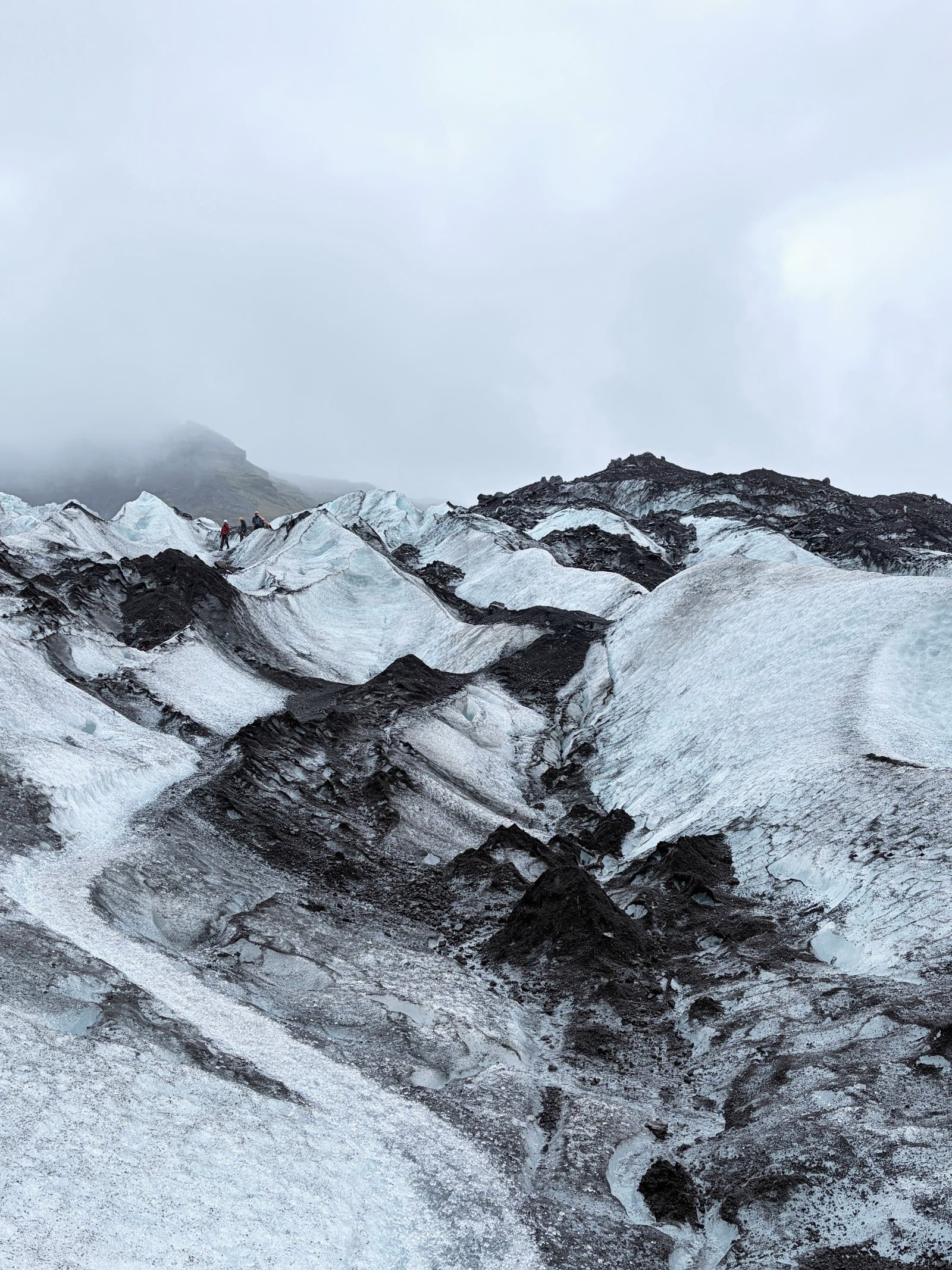
The plumbing is what makes this glacier unusual. Two icefalls feed it — one descending from the Vatnajökull ice cap, one from the Öræfajökull volcano — each about 1 km wide and 400 m tall, merging behind the dark medial moraine that streaks the tongue down its full length. Average ice thickness is 250 m. The snout sits in an overdeepened basin roughly 6 km long, of which 5 km is still ice-filled below the surface. That shape explains the lake: as the tongue thins, meltwater fills the basin instead of draining away.
The foreland between the visitor centre and the ice is one of the clearest glacial landscapes in Iceland. A bulky composite push moraine marks the near-stable decades from the 1960s to the 1990s. In front of it, a train of metre-high sawtooth recessional moraines, laid down almost yearly until 2010, counts off the retreat like tree rings. Rare V-shaped hairpin moraines from short-lived advances also occur here — glaciologists travel a long way to see them. Scattered through the ground are kettle holes, ponds left where buried blocks of ice melted in place, and the so-called glacier gardens pointed out on the marked S1 route.
The setting finishes the picture. Kristínartindar, the 1,126 m twin-peaked mountain east of the heath, gives the classic panorama: from the 18 km S4 circuit you can trace both icefalls, the medial moraine and the whole retreat record of the foreland in a single look. West of the glacier, Svartifoss drops about 20 m against a wall of hexagonal basalt columns — the formation architect Guðjón Samúelsson echoed in Reykjavík's Hallgrímskirkja. Three glacial rivers drain the area — Skaftafellsá, Morsá and Skeiðará — the last crossing Skeiðarársandur, considered the world's largest glacial outwash plain, which the Ring Road spans on long, straight bridges.
For the people of this district, the deepest memory is 1362. The Öræfajökull eruption destroyed the settlement, and the region has carried the name Öræfi — 'the wasteland' — ever since. It sits on the road signs, the maps and the parish names, a daily reminder that the volcano above the glacier emptied this coast once already and erupted again in 1727. Icelanders treat Öræfajökull accordingly: it is the country's tallest volcano, and its eruptions rank among the most destructive in Icelandic history.
In modern Iceland the glacier has a second role as the country's most quotable example of climate change. Retreating an average of 53 m a year since 1999 and calving into a lake that formed in 2010, Skaftafellsjökull turns up in news coverage and school materials, and the Melting Glaciers project on the S1 trail marks the ice's former positions for anyone who walks it. Svartifoss carries the region into architecture — the hexagonal columns of Guðjón Samúelsson's Hallgrímskirkja, the church that anchors Reykjavík's skyline, echo the waterfall's basalt wall. Next door, Svínafellsjökull has served as a filming location for international productions.
The local economy has rebuilt itself around the ice. Höfn, 130 km east, is Iceland's langoustine capital and now the natural overnight stop for glacier trips; the shop at the Skaftafellsstofa visitor centre stocks regional handicrafts rather than generic souvenirs; and the campsite and base camps keep rangers and guides in the district year-round. For a place written off as a wasteland in 1362, that's quite a turnaround.
The hexagonal basalt columns behind Svartifoss inspired the design of Hallgrímskirkja, the church that defines Reykjavík's skyline. Architect Guðjón Samúelsson borrowed the formation's geometry directly.
After the 1362 Öræfajökull eruption — the largest pumice eruption in Iceland's recorded history — destroyed the local community, the district became known as Öræfi, literally 'the wasteland'. The name is still used today.
Around 1700, Skaftafellsjökull and neighbouring Svínafellsjökull merged, trapping mount Hafrafell between them. The mountain stayed locked in ice until 1935.
The 5 November 1996 jökulhlaup from the Gjálp eruption peaked at an estimated 50,000 m³/s, tore out an 880 m bridge and dumped 12.8 million m³ of sediment across Skeiðarársandur.
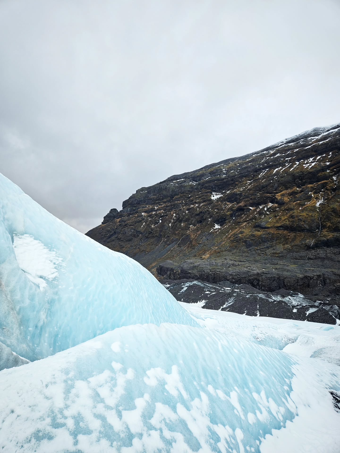
Skaftafellsjökull has retreated so far that it now ends in a lake, and no tour operator takes clients onto it. Guided glacier hikes run on nearby Falljökull instead.
Svínafellsjökull, on the far side of Hafrafell, is one of Iceland's most used glacier filming locations. It's a short drive east of the Skaftafell visitor centre.
The blue ice caves at Skaftafell reform in a different spot each autumn, so every season's cave is genuinely new. The current canyon-style cave has no roof, which makes it Iceland's best ice cave option for claustrophobic visitors.
No, entry to Vatnajökull National Park is free. You pay a regional parking fee instead: ISK 1,110 for a car with 5 or fewer seats, valid until midnight, collected by automatic licence-plate photo and payable via the Parka app, machines or online. Camping costs ISK 2,800 per adult per night.
No. The glacier has retreated so far that it now ends in a proglacial lake, and tour companies no longer take clients onto it. Guided glacier hikes run on nearby Falljökull instead, departing from Skaftafell Base Camp with crampons, harness and helmet provided.
The signed S1 Jökulslóð loop is 4.1 km and takes 1-1.5 hours at easy grade, crossing the moraine to a viewpoint facing the ice front across the glacial lake. Numbered markers from the Melting Glaciers project explain the retreat along the way.
Yes — any travel on glacier ice requires a certified guide and technical gear, and unguided access is dangerous. Tours from Skaftafell run year-round: 3-hour hikes from about ISK 13,126 per person (minimum age 8) and 4-hour ice-cave combinations from October to April.
Waterproof hiking boots with hard soles (crampons need them), a waterproof jacket and trousers, gloves and a hat, worn in layers. Jeans are banned on the ice. The glacier runs a few degrees colder and much windier than the car park, and boots and rain gear are usually available to rent.
Only in the zone directly in front of Skaftafellsjökull, during seasonal windows — for example before 09:00 or after 18:00 between May 1 and September 15. Everywhere else in Skaftafell, including Svartifoss, recreational drones are prohibited for bird protection. Commercial filming needs a park permit.
Roughly October 1 to April 30, when 4-hour combination tours visit a blue ice cave plus the glacier, with departures around 9:00, 10:00, 13:30 and 14:00. The caves reform in new locations each autumn, so exact openings depend on the ice each year.
Yes — the campsite sits next to the visitor centre, within walking distance of both the glacier viewpoint and Svartifoss. It costs ISK 2,800 per adult per night (ISK 2,300 for seniors 67+ and disabled visitors), children 16 and under stay free, and electricity is ISK 1,500 per 24 hours. Spots can't be reserved, so arrive early in July and August.
Strætó route 51 links Reykjavík with Höfn via Vík and Skaftafell in summer, costing ISK 13,200 one-way for adults (half price for ages 12-17, seniors and disabled; children 0-11 free). Timetables are seasonal and reduced, so check straeto.is before planning. Guided South Coast day tours also include the stop.
Not hard — the 5.8 km round trip takes about 2 hours and is graded 'Easy +', though it includes wooden and stone steps that can tire weak knees. En route you pass Hundafoss and Magnúsarfoss, and the final waterfall drops roughly 20 m against hexagonal basalt columns.
Browse verified tours with free cancellation and instant confirmation.
Find Tours