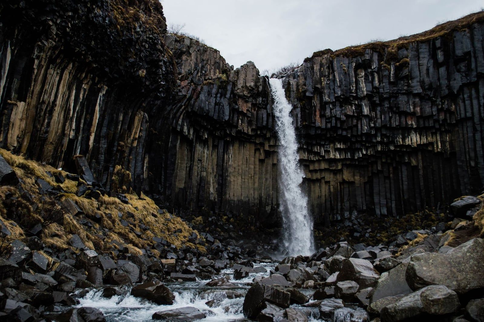
Svartifoss drops about 20 m (66 ft) through a curtain of black, hexagonal basalt columns, and it's the sight most people remember from Skaftafell. You can't see it from the car: the falls hide in a ravine inside the birch woodland of Vatnajökull National Park, and you reach them on foot past two smaller waterfalls. Entry is free, the trail is open around the clock, and the same trailhead doubles as the base camp for glacier hikes on the surrounding ice.
That combination — a short but genuinely rewarding hike, geology you won't find at Iceland's roadside falls, and a glacier landscape on the doorstep — is why Svartifoss earns a spot on nearly every South Coast itinerary. This guide covers the trail numbers (there are several conflicting ones out there), parking costs, seasons, photography, and how to pair the falls with the rest of Skaftafell.
What Is Svartifoss Waterfall and Why Is It Famous?
Svartifoss means "Black Falls," a name it earns from the dark basalt wall behind the water. The falls sit inside Skaftafell, the former national park that merged into Vatnajökull National Park in 2008 and is now part of a UNESCO World Heritage Site. Its coordinates are 64.0275° N, 16.9753° W — 327 km east of Reykjavík, deep in South Coast territory.
The columns are the whole story. An ancient lava flow cooled slowly here, and as it crystallised it contracted into the hexagonal prisms you see today — the same physics that makes the Giant's Causeway. What makes Svartifoss unusual is that the cliff is still shedding: fresh column sections shear off faster than the falling water can wear down their edges, so the base is littered with sharp black debris. That debris is exactly why your viewpoint is a fenced platform rather than the streambed.
The geometry has travelled. Guðjón Samúelsson drew on these columns for Hallgrímskirkja, Reykjavík's landmark church; they echo in the ceiling of the Icelandic National Theatre; and Richard Serra's Milestones sculpture on Viðey Island is usually counted in the same lineage. Not bad for a 20-metre waterfall in a ravine.
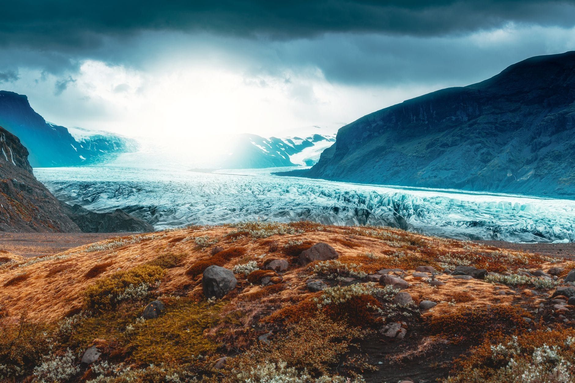
The water itself is glacial. The river Stórilækur starts at Svínafellsjökull, an outlet glacier of Vatnajökull (Europe's largest ice cap), and runs 7.38 km before joining the Skaftafellsá. Meltwater this close to the source is near-freezing year-round — one more reason nobody swims here. Around the falls, the setting softens: a green pocket of birch woodland between glacier tongues, a short detour off the Ring Road.
How to Get to Svartifoss
There is exactly one trailhead: the Skaftafell Visitor Centre (Skaftafellsstofa). From the Ring Road (Route 1), take the signed Skaftafell turnoff onto road 998; the car park is at the end, a couple of minutes' walk from the visitor centre. For full route and transport detail, see our guide to getting to Skaftafell.
Distances are straightforward. Reykjavík is 327 km west — about 4 to 4.5 hours of driving. Höfn is 130 km east, 1.5 to 2 hours. Vík is roughly 2.5 hours back west, with Kirkjubæjarklaustur 69 km from the park; the mossy canyon of Fjaðrárgljúfur near Klaustur makes a natural stop on that stretch.
Don't try it as a Reykjavík day trip. The round trip is 650-plus km and eight-plus hours behind the wheel, which is why no operator runs a dedicated day tour from the capital — only multi-day South Coast packages include the stop. Base yourself in Vík or Höfn instead, or camp at Skaftafell itself.
Car-free travellers do have an option: Strætó route 51 links Reykjavík with Höfn via Vík and stops at Skaftafell, with daily summer service. An adult one-way fare is ISK 13,200 (children 11 and under ride free). Timetables shrink outside summer, so check straeto.is before committing to a car-free plan.
For an overnight, the choice is between hotels in Vík or Höfn and the Skaftafell campsite beside the trailhead. Campers get the best deal of all: first onto the trail in the morning and last off it at night. Our Skaftafell National Park guide covers the area's history and sights in more depth.
The Svartifoss Hike: Route, Distance & Difficulty
Published figures for this hike conflict wildly — 1.5 km, 4.24 km, 5.5 km — because they describe different routes. Vatnajökull National Park's official data separates them cleanly, and it's worth knowing which one you're actually hiking.
| Route | Distance | Time | Difficulty |
|---|---|---|---|
| Direct out-and-back | ~3 km return | 1.5–2 h | Easy to moderate |
| S2 loop (Svartifoss–Sjónarsker–Sel) | 5.8 km circular | ~2 h | Easy + |
| S6 extension to Sjónarnípa | 7.1 km | 2.5–3 h | Challenging |
The Direct Route, Step by Step
From the visitor centre, the path runs through the campground and starts climbing immediately — wooden steps and platforms threading up through birch forest. The official route gains about 140 m in the first 1.5 km before the first viewpoint, a perch above the falls that gives you your first proper look at the columns.
From there the path drops into the ravine to the fenced viewing platform, then crosses a footbridge for a second angle from the other side, where natural basalt-column steps climb back out. On the way up you'll pass two other waterfalls: Hundafoss first, then Magnúsarfoss (some guides also count a third, Þjófafoss). Allow 45 minutes up and 1.5 to 2 hours total. Expect mud near the falls and spray at the platform.
The S2 Loop via Sjónarsker and Sel
The official route doesn't turn back at the falls. It continues to the Sjónarsker viewpoint, past the old turf house at Sel, and returns through the Lambhagi birch scrub — 5.8 km all told, at an easy grade. The junctions aren't always obvious in the forest, so download the park's official GPX track or follow a GPS line rather than guessing. The S6 extension pushes on to Sjónarnípa itself, with views toward Kristínartindar, Hrútfjallstindar and Öræfajökull — worth it only if your legs are fresh and the weather holds.
Difficulty and Accessibility
The park grades the walk "Easy +," which is honest: it's uphill nearly all the way, on wooden and stone steps, and the park's own trail notice warns the path can be slippery in wet summer conditions, very slippery or snow-covered in winter, and hard work for anyone with weak legs. There is no viewing Svartifoss without hiking — it's invisible from both the road and the car park — and the trail is not suitable for wheelchairs or limited mobility.
If someone in your group can't manage the climb, they haven't wasted the drive. The visitor centre, café and toilets are a short, flat walk from parking, and the 4.1 km S1 glacier-viewpoint loop is a gravel path with no steps — an easy walk to the ice front. Iceland's P-parking card holders can also email the park in advance for a parking-fee exemption.
Parking, Fees & Facilities at Skaftafell
There is no entrance fee for the park or the trail. The only mandatory cost is parking: ISK 1,110 for a passenger car with five seats or fewer (ISK 1,440 for 6–9 seats, ISK 450 for a motorcycle), collected by automatic licence-plate photo and payable via the Parka app, the machines, or online. The fee is valid until midnight on the day you pay — and if you visit Jökulsárlón the same date, the second area is half price, so keep both stops on one day.
A second, smaller car park sits closer to the falls and cuts roughly 0.5 km of walking, but it's less clearly signed and can close in bad weather. If you find it open, use it; if not, the visitor-centre lot is the reliable default.
At the visitor centre you'll find toilets, a café (mainly summer, with reduced winter hours), drinking-water refill, large trail maps and staff who know the day's conditions. It's open year-round — 09:00–19:00 in June–August, 10:00–17:00 in January–February and December — and current details live on our hours and fees page.
The campsite beside the trailhead runs 1 May to 30 September: showers, laundry, WiFi and electricity hook-ups, at ISK 2,800 per adult per night (ISK 2,300 for seniors 67+, free for children 16 and under, electricity ISK 1,500 per 24 hours). Spots can't be reserved, so arrive early in July and August. For photographers and early risers, it's the best bed in the district.
Best Time to Visit Svartifoss (and How to Beat the Crowds)
June through August is the default answer: daytime highs of 10–15°C, clear trails, lush green birch forest, and near-24-hour daylight around the June solstice. July is typically the warmest and busiest month. The site never closes — the trail is open 24 hours a day, year-round.
Shoulder seasons trade some weather reliability for elbow room. Autumn gilds the birch forest and thins the crowds; spring meltwater pushes the falls to their fullest. Both can deliver the better visit if you're dressed for changeable days.
Winter is a different hike entirely. The columns wear snow and icicles, but the path gets icy and, at midwinter, you're working with only four to five hours of daylight. Sturdy boots with microspikes or crampons are essential, and the park's advice is to ask at the visitor centre about current trail conditions before setting out. The reward is a version of Svartifoss most visitors never see.
So which matters more to you, light or solitude? Mid-day is peak crowd but peak light — the south-facing gorge is sunlit then, sometimes with a rainbow in the spray. Before 10 am or after 6 pm in summer, you'll often have the platform to yourself, and the midnight sun makes a 9 pm hike entirely reasonable.
Photographing Svartifoss: Light, Angles & Drone Rules
The gorge faces south, so the falls take direct sun from mid-day into early afternoon in summer — occasionally enough to hang a rainbow in the spray. Early morning and late evening throw shadows across the columns instead, which has its own appeal. Overcast is underrated: soft, even light does the most for the texture of dark basalt.
Your compositions come from the fenced viewing platform and the surrounding boardwalk, plus the footbridge for a second vantage. The fence is not negotiable — it protects the vegetation, and the rock beyond it is loose. Plan around those two angles:
- Wide-angle lens — the only way to fit falls and columns together from the platform.
- Tripod plus ND filter for silky long exposures of the water.
- Circular polarizer to cut glare off wet black rock.
- Bracket your exposures — white water against dark basalt is brutal contrast.
Drones are a hard no. Recreational flying is prohibited across most of Skaftafell — Svartifoss included — for bird protection and visitor safety; the only permitted zone is in front of Skaftafellsjökull, and only during set seasonal time windows. Commercial filming needs a park permit. Leave the drone in the car.
What to Wear & Bring for the Svartifoss Hike
The climb generates heat even on cold days, and Iceland can move through four seasons on a single ascent, so dress in layers you can shed. What the trail actually demands is grip and waterproofing — the last stretch runs muddy, and spray reaches the platform.
- Wool or synthetic baselayer, fleece midlayer, waterproof shell.
- Sturdy hiking shoes or boots — the wooden and stone steps get slick.
- Microspikes or crampons from late autumn through early spring.
- A trekking pole for balance on the descent.
- Water bottle (refill free at the visitor centre) and snacks — buy them in Vík or Höfn; the café is seasonal.
Keep your camera reachable rather than packed away, and give it a wipe after the platform — the spray is fine, persistent mist.
Beyond the Falls: Pairing Svartifoss with Skaftafell's Glaciers
Svartifoss takes two hours; almost nobody leaves Skaftafell that quickly. The falls sit inside a working glacial landscape, and the same car park serves all of it.
Add the Glacier Viewpoint (+1 Hour)
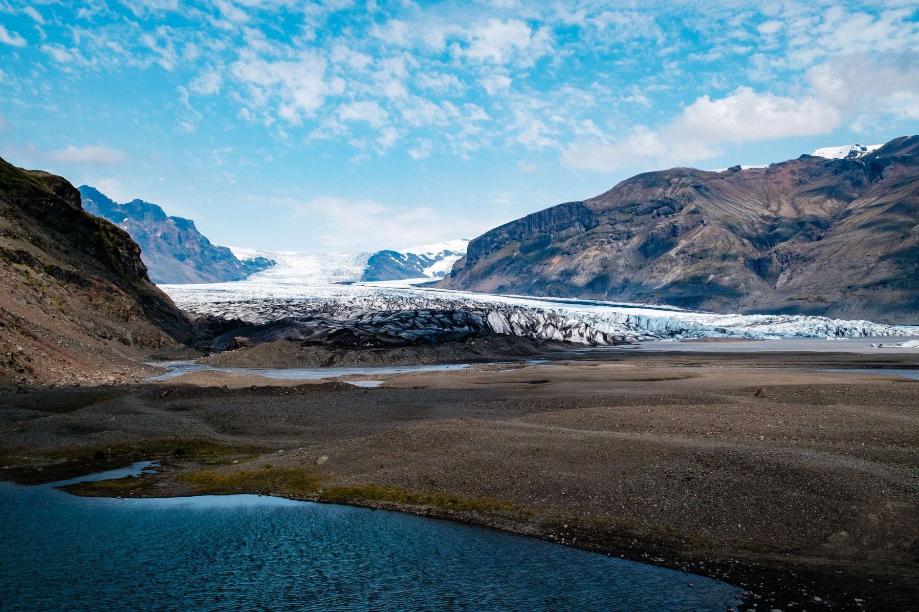
The S1 Jökulslóð loop starts from the same trailhead: 4.1 km, 1 to 1.5 hours, easy grade, on a gravel path across the glacial foreland past kettle holes and moraine ridges, with numbered markers explaining the glacier's retreat. It ends at a viewpoint facing the Skaftafellsjökull snout across a proglacial lake that has only existed since about 2010. Falls plus viewpoint is the classic Skaftafell half-day — roughly three hours of walking, all of it from one parking ticket.
Guided Glacier Hikes and Ice Caves
You can't walk on Skaftafellsjökull itself anymore — it has retreated too far and now ends in that lake. Guided hikes run on the nearby Falljökull tongue instead, departing from Skaftafell Base Camp beside the campsite: about three hours on the ice with crampons, harness and helmet provided, from roughly ISK 13,126 per person, minimum age 8. From 1 October to 30 April, four-hour combination tours add a blue ice cave — the caves reform in a new spot each autumn, so every season's cave is genuinely different. Browse guided glacier hikes and ice cave tours for departure times, or read our Skaftafell glacier hike guide first. Going onto the ice alone is never an option.
Longer Official Routes
If Svartifoss is a warm-up, the park has bigger days. The S3 Skaftafellsheiði circuit covers 16.6 km in 5–6 hours across the heath. The S4 Kristínartindar route is 18 km, 6–8 hours, rated difficult and reserved for experienced hikers — storms close it regularly. The heath trails toward Morsárjökull pass Morsárfoss, Iceland's highest waterfall, hidden in a gorge most Ring Road traffic never knows exists. Ask the rangers at Skaftafellsstofa (phone 470 8300) before committing to any of them.
Along the Ring Road
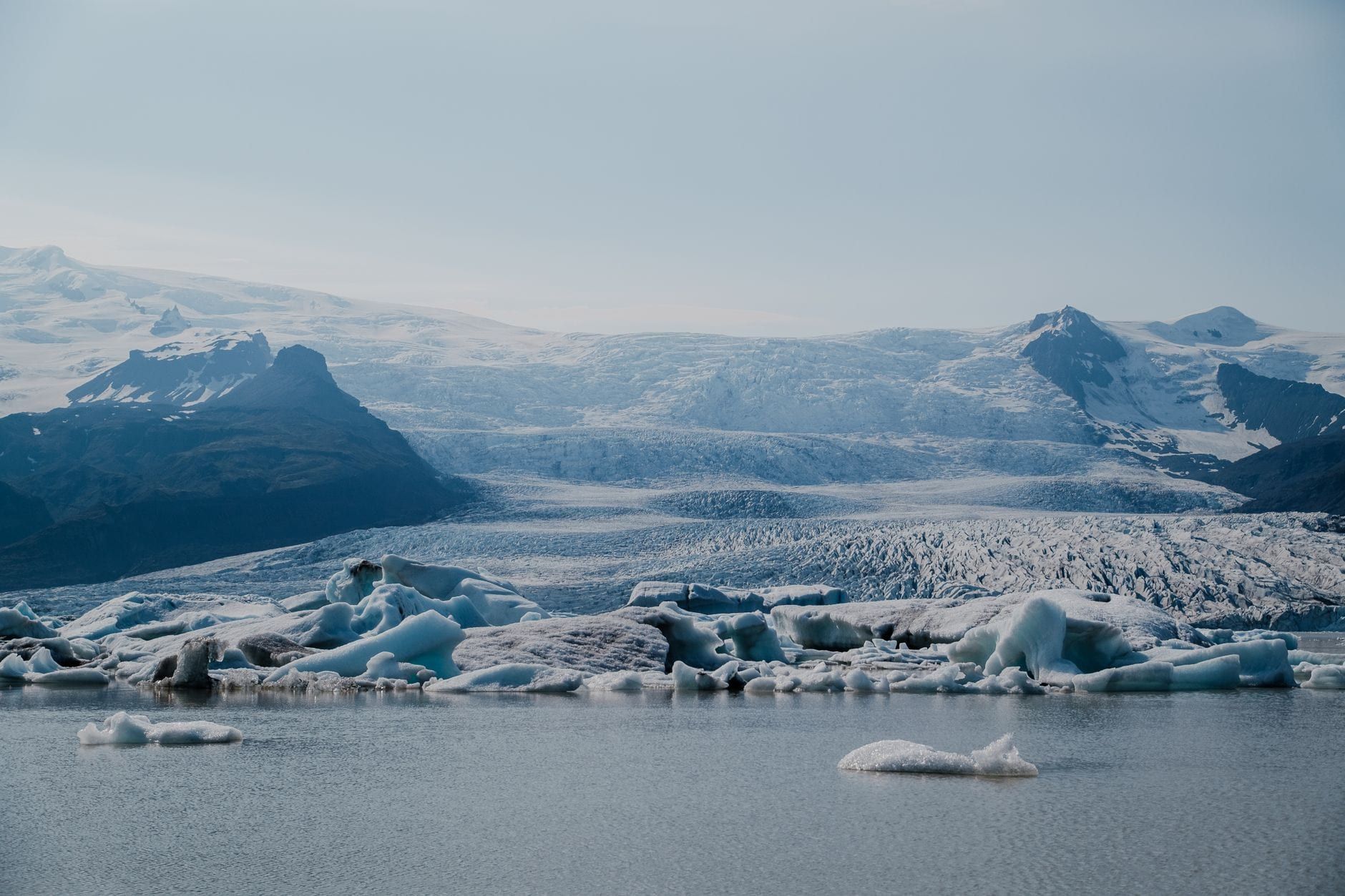
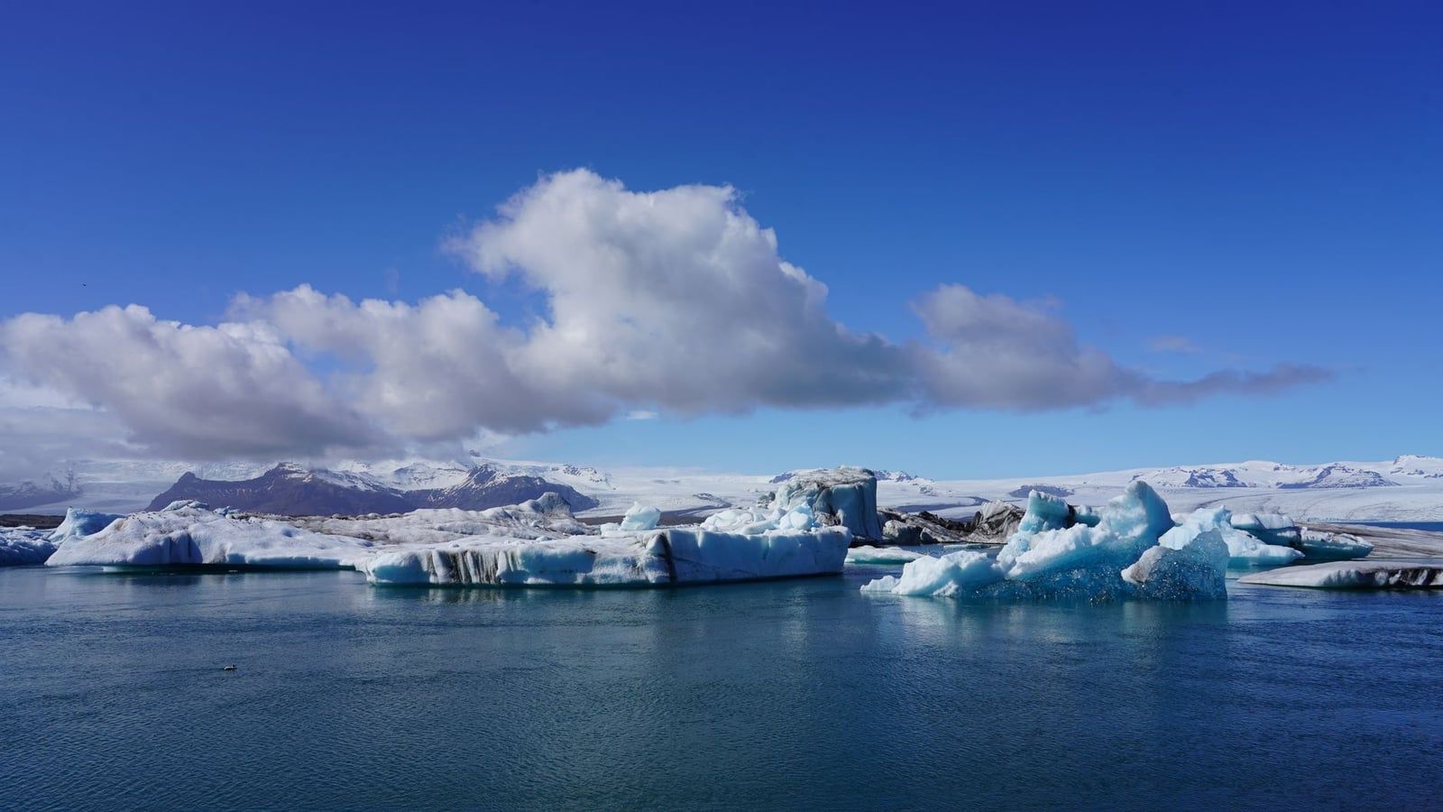
East, 57 km (45 minutes to an hour) away, Jökulsárlón Glacier Lagoon and Diamond Beach are the natural afternoon pairing — icebergs calving into the lagoon, ice shards on black sand. West, the twisted steel girders of the Skeiðará Bridge Monument, 15–20 minutes from the park, are all that remains of an 880 m bridge torn apart by the 1996 jökulhlaup. Further west near Kirkjubæjarklaustur, Fjaðrárgljúfur canyon makes the drive back toward Vík something other than empty kilometres.
Svartifoss Waterfall: Frequently Asked Questions
The questions that come up most often, answered with the figures used throughout this guide.
Frequently asked questions
How long is the hike to Svartifoss?
The direct out-and-back is about 1.5 km each way from the Skaftafell Visitor Centre — roughly 45 minutes up, 1.5–2 hours round trip with photo stops. The official S2 loop via Sjónarsker and Sel is 5.8 km and takes about 2 hours.
Is Svartifoss free to visit? What does parking cost?
There is no entrance or hiking fee. Parking at Skaftafell costs ISK 1,110 for a car with five seats or fewer, paid via the Parka app, machines or online, and is valid until midnight on the day of payment. Visiting Jökulsárlón the same date gets you 50% off the second area.
Can you see Svartifoss without hiking, and is it wheelchair accessible?
No. The falls are hidden in a ravine and invisible from both the road and the car park. The trail climbs about 140 m on wooden and stone steps, so it's not suitable for wheelchairs or limited mobility; the visitor centre and the step-free S1 glacier-viewpoint loop are the realistic alternatives.
Can you swim at Svartifoss or walk behind the waterfall?
No to both. A fenced viewing platform is the only access point — the base is strewn with sharp rock because fresh basalt columns shear off faster than the water wears them down — and the water is near-freezing glacial meltwater from Svínafellsjökull.
Are drones allowed at Svartifoss?
No. Recreational drones are prohibited across most of Skaftafell, and Svartifoss is completely off-limits. The only permitted flying zone is in front of Skaftafellsjökull, during strict seasonal time windows.
Is Svartifoss open year-round? What is it like in winter?
Yes — the trail is open 24/7 year-round. Winter means an icy, often snow-covered path (microspikes or crampons advised), about four to five hours of daylight at midwinter, and snow-capped columns. Check conditions at the visitor centre before setting out.
How much time do you need at Svartifoss?
About two hours covers the direct out-and-back plus time at the platform. Add another hour for the S2 loop, or a further 1–1.5 hours if you also walk the Skaftafellsjökull viewpoint trail.
Where does the water in Svartifoss come from?
The river Stórilækur, which originates at the Svínafellsjökull outlet glacier of Vatnajökull and runs 7.38 km before joining the Skaftafellsá.
Sources
- vatnajokulsthjodgardur.is/en/areas/skaftafell/svartifoss-sjonarsker-sel-s2
- vatnajokulsthjodgardur.is/en/areas/skaftafell/destination-skaftafellsjokull
- vatnajokulsthjodgardur.is/en/communities--businesses/pricelist
- vatnajokulsthjodgardur.is/en/thenationalpark/drone-rules
- vatnajokulsthjodgardur.is/en/areas/skaftafell
- en.wikipedia.org/wiki/Svartifoss
- straeto.is/